Get disease-specific map: distribution of cases by Member State
getMap.RdFunction returning the disease-specific PNG map previously created
and stored in a specific folder (see pathPNG argument) and
that will be included in the epidemiological report at the bookmark location
of the template report, depending of the type of map.
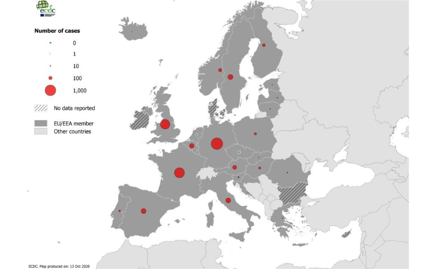
Three type of maps can be included in the report:
Bookmark
'MAP_NB': Distribution of cases by country. An additional caption will be included at the location of the bookmark'MAP_NB_CAPTION'.Bookmark
'MAP_RATE': Distribution of cases per 100 000 population by country. An additional caption will be included at the location of the bookmark'MAP_RATE_CAPTION'.Bookmark
'MAP_ASR': Distribution of cases using age-strandardised rates per 100 000 population by country. An additional caption will be included at the location of the bookmark'MAP_ASR_CAPTION'.
(see ECDC reports https://www.ecdc.europa.eu/en/publications-data/monitoring/all-annual-epidemiological-reports)
Usage
getMap(
  disease = "DENGUE",
  year = 2019,
  reportParameters = EpiReport::AERparams,
  index = 1,
  pathPNG = system.file("maps", package = "EpiReport"),
  doc
)
Arguments
- disease
character string, disease code (default
"DENGUE").- year
numeric, year to produce the map for (default
2019).- reportParameters
dataframe, dataset including the required parameters for the map and report production (default
AERparams) (see specification of the dataset in the package vignette withbrowseVignettes(package = "EpiReport"))- index
integer, figure number
- pathPNG
character string, full path to the folder containing the maps in PNG (default 'maps' folder included in the package
system.file("maps", package = "EpiReport"))- doc
'Word' document (see
'officer'package) in which to add the maps at the bookmark location. If doc is missing,getMapreturns a preview of the PNG image.
See also
Global function for the full epidemilogical report: getAER
Required Packages: body_replace_img_at_bkm
Internal functions: includeMap previewMap
Default datasets: AERparams
Examples
# --- Preview of the PNG map using the default Dengue dataset
getMap()

#> [1] "/home/runner/work/_temp/Library/EpiReport/maps/DENGUE_2019.ALL.COUNT.png"

# --- Plot using external PNG image
# --- Please see examples in the vignette
browseVignettes(package = "EpiReport")
#> No vignettes found by browseVignettes(package = "EpiReport")
#> [1] "/home/runner/work/_temp/Library/EpiReport/maps/DENGUE_2019.ALL.COUNT.png"
# --- Plot using external PNG image
# --- Please see examples in the vignette
browseVignettes(package = "EpiReport")
#> No vignettes found by browseVignettes(package = "EpiReport")